Water Utility
InVision specializes in water utility GIS implementation. We help you develop a powerful GIS that becomes an integral part of your day-to-day operations. We have worked with water operations crews, metering, and water treatment plants and understand the essential components that make up each system.
InVision can assist at any level in your GIS organization:
- Convert CAD data
- Collect GPS data
- Read and convert as-built drawings
- Provide training to your employees
- Build data in shapefiles into a geodatabase
- Provide full functionality of your GIS tools
- Build robust personal, file, or enterprise SQL Server ArcSDE implementations.
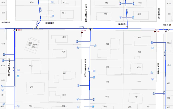
It is essential to understand the unique characteristics of a water utility and the fundamental role GIS plays when managing the utility. Through GIS, InVision can model the water utility using a geometric network. A geometric network is critical for editing infrastructure and maintaining flow in the system, as well as quickly finding and isolating leaks, and determining pipes disconnected from the system. More importantly, a geometric network provides a straightforward transition to a water modeling system.
InVision also strategically builds a water GIS, which can include a GIS-centric work order system, while bearing in mind the future needs of the organization. GIS-centric work order systems allow users to have a powerful spatial component, which is not found in more common flat-file systems. It also allows users to create work orders from the map, select features on the map, and find related work orders. Your work order system will provide a tool for analysis, budgeting, and tracking state requirements. Instead of a paper map on the wall, your leak work orders will now be a searchable database filled with work history, water loss, and data needed to support waterline replacement--all available for quick mapping display.

InVision is creating this powerful water GIS for the Town of Estes Park, Colorado.